
Seismology in Schools (Seismeolaíocht sa Scoil) Pilot Project
![]() Seismology in Schools now has a Facebook page
Seismology in Schools now has a Facebook page
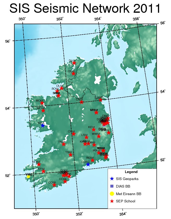
An Outreach pilot programme called Seismology in Schools (Seismeolaíocht sa Scoil) was introduced by the Dublin Institute for Advanced studies to 50 primary and secondary schools throughout Ireland in 2007. Currently there are 55 primary and secondary schools in the programme and has now been extended to include colleges, universities and geo-parks. Using the seismometer and associated software distributed in this programme, students are able to record and study earthquakes from the other side of the world in real-time. Students monitor the performance of the seismometer daily and consolidate the learning and data collection techniques outlined in the training days. Ultimately students upload the recorded earthquake data to the International Schools in Seismology website to share their earthquake data with other schools initially in Ireland, the UK, and USA. The experience of the Seismology in Schools pilot programme reinforces the idea that when science is relevant, learners become more engaged when they see how science is reflected in the reality of their own lives and by what they read in the media.
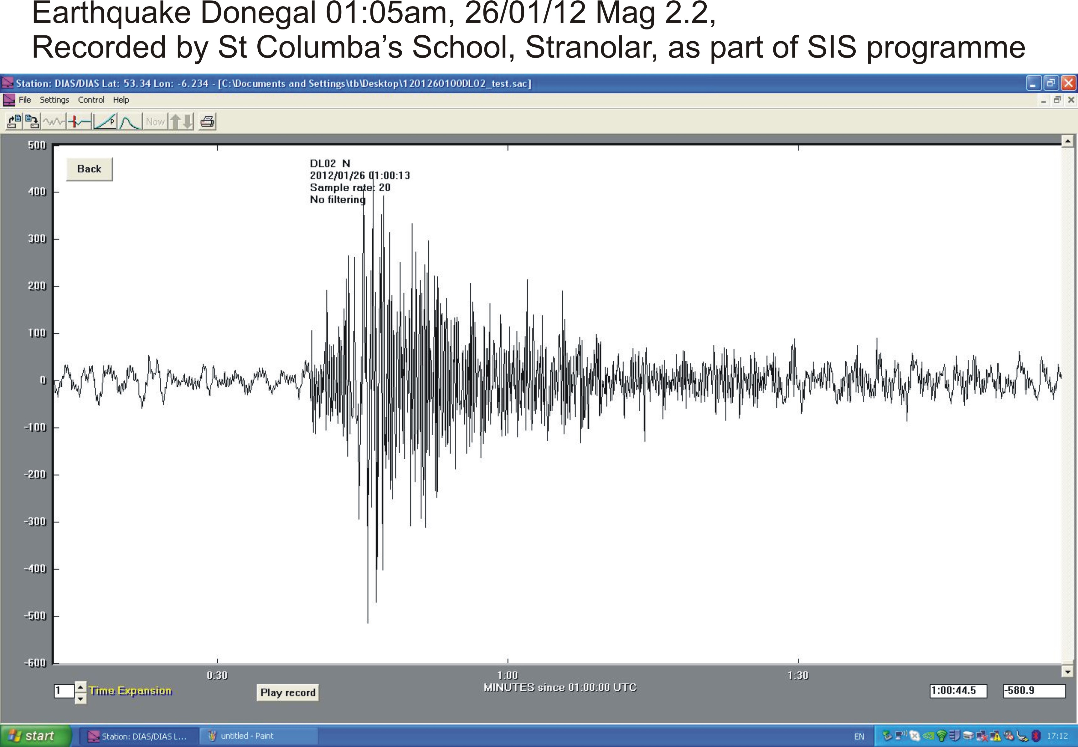
Earthquake in Donegal, Ireland, 26th January 2012, Magnitude 2.2mb
Both the St Egney Primary School, Buncrana and the St Columba Secondary School, Stranolar also recorded the seismic event on their own school seismometers, which they use as part of the DIAS Outreach Seismology in Schools programme. For the location and more information on the event please click here. Earthquake in Eastern Turkey, 23rd October 2011, Magnitude 7.2mb
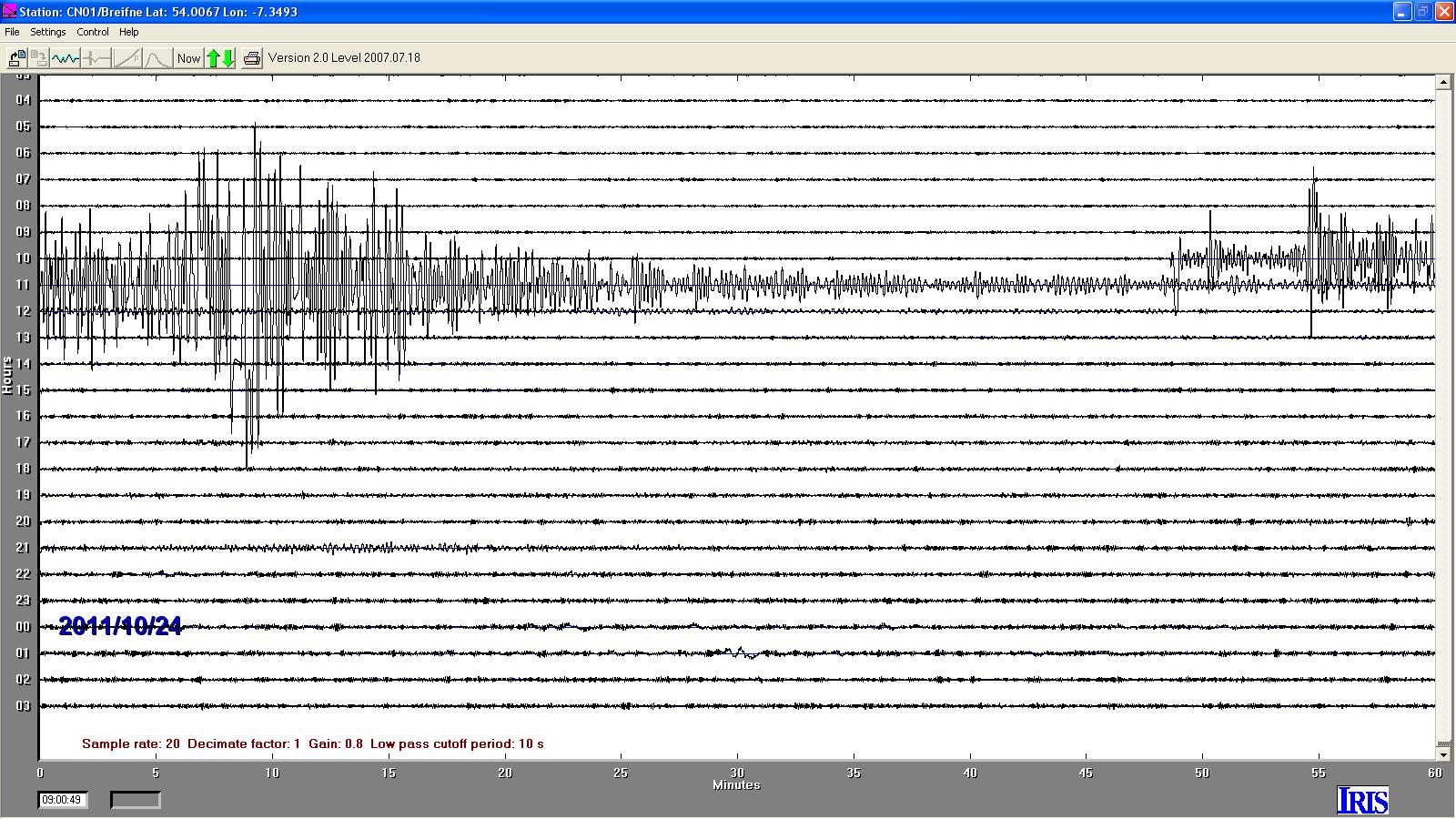
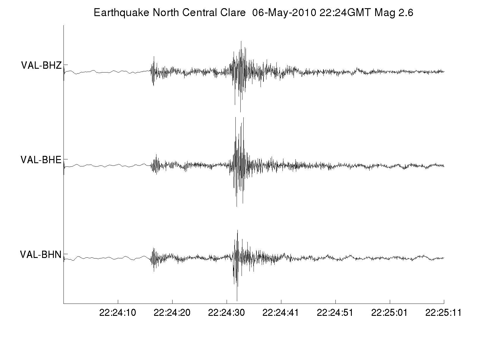
This earthquake was successfully registered by several of the participating schools. This trace was recorded at Scoil Breifne, Co. Cavan. Largest recorded earthquake in Co. Clare, May 2010
The image is a recording of the earth tremeor as recorded by the station at Valentia Met Station, Caherciiveen, Co Kerry. Please click image to view it. Here are a list of related news articles: |
For information please contact: Tom Blake tb@cp.dias.ie
 |