


The 3D model (basic bathymetry topography setting)
Secret model responses
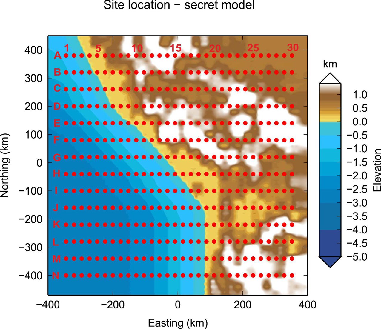
The 3D model test data set consists of 420 sites which are equally distributed over an coastal area of about 800 km x 800 km with bathymetry and topography included. There are 14 profiles with 30 sites each. The spacing between the sites is 24km in East-West direction and between the profiles is 60 km.
The period range of the data set is 0.07 s to 40 000 s (24 periods: 7.113119E-02, 1.264911E-01, 2.249365E-01, 4.000000E-01, 7.113119E-01, 1.264911E+00, 2.249365E+00, 4.000000E+00, 7.113119E+00, 1.264911E+01, 2.249366E+01, 4.000000E+01, 7.113119E+01, 1.264911E+02, 2.249365E+02, 4.000002E+02, 7.113119E+02, 1.264911E+03, 2.249365E+03, 4.000000E+03, 7.113119E+03, 1.264911E+04, 2.249365E+04. 4.000000E+04 ) and the resistivity of halfspace can be set to 100 Ωm. Please keep in mind that some of the data can be strongly effected by coastal effects.
The most interesting are responses for sites on the sea bottom where we are experiencing problems with coastal effects and strong contrast between ocean water and basement. It's recommended to run forward solution with bathymetry and topography in the starting model to check quality of your responses.
Download sites locations information here. The topography and bathymetry of the area can be downloaded here. Download secret model responses in edi format here. Keep in mind, that WGS84 coordinates in the edi files are just approximate and should be use with caution in any visualization or conversion tools! You have to check your coordinates according to sites location information file! The coordinate system used in the edi files: true origin is (0,0); easting and northing is (0,0); fo is 0.996.

Dublin Institute for Advanced Studies, School of Cosmic Physics, 5 Merrion Square, Dublin 2, Ireland
Tel +353 - 1 - 6535147, Fax +353 - 1 - 443 - 0575, vozar@cp.dias.ie
